Introduction
ARLAS Exploration is an Open Source software for exploring and analysing Geo BigData.
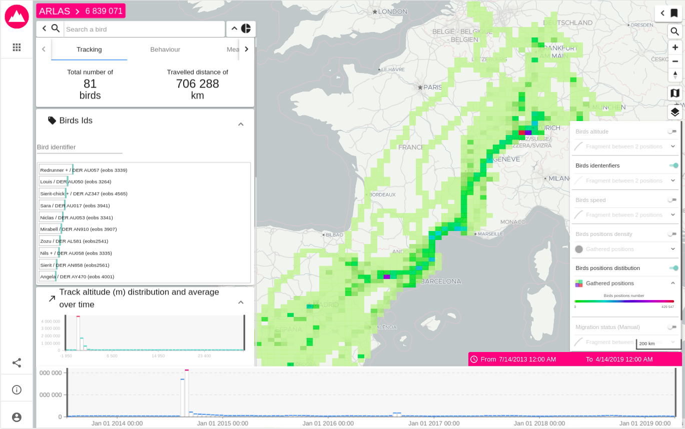
figure 1: Global view of ARLAS-wui, the exploration application, presenting Storks movements as an example
This exploration can be performed thanks to a modern and fluid Web Application called ARLAS-wui that offers many analysis tools:
Map
- Displays the real geographical entities composing your data when the number of features is low enough to be readable on a map - Geometric Features mode
- Displays the geographical distribution of data in the form of heatmaps or grids - Cluster mode
- When geographical entities of your data correspond to an event emitted by an element: measurements emitted by a pollution station or bus passages through a stop, the map displays an aggregation of these events by emitter - Network Analytics mode
- Allows geographical filters by drawing bounding boxes on zones of interest
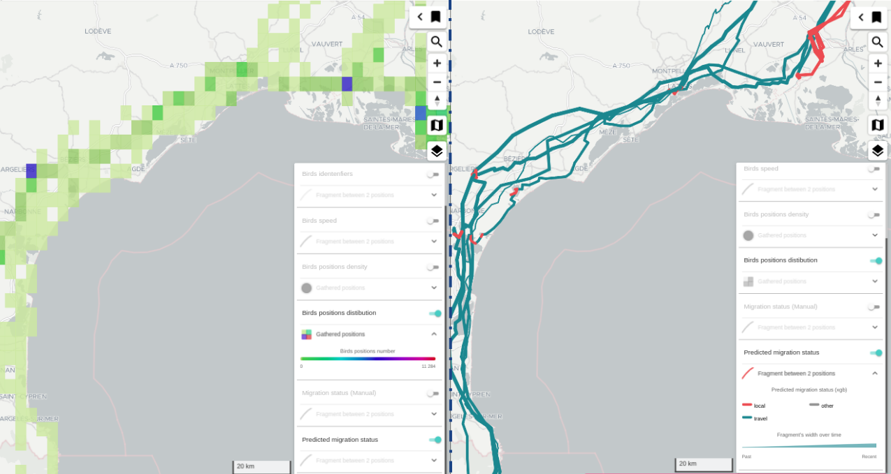
figure 2.1: Geographical distribution of storks movements (Cluster mode) VS actual storks movements (Geometric Features mode)
Tip
The more you filter your data and zoom in the map, the closer you get to the switch from aggregation to feature mode
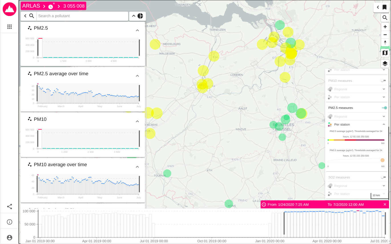
figure 2.2: PM2.5 Pollution measurements aggregated by station (Network Analytics mode)
Analytics board
- Displays the data fields distribution in the form of histograms, donuts or progress bars
- Displays data tables
- Allows to apply filters by interacting with each analytic view (draw intervals in histograms, select nodes on donuts, ...)
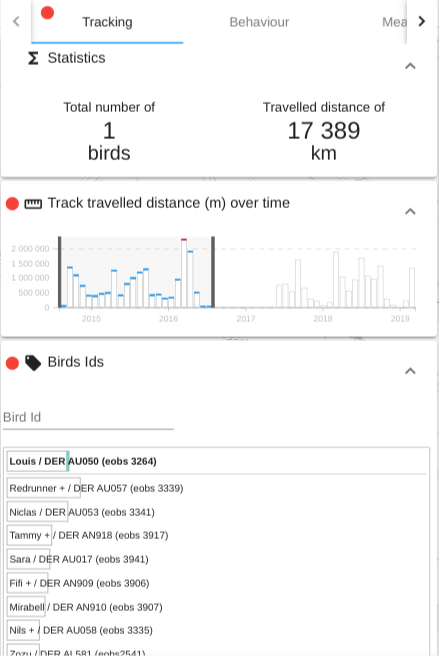
figure 3: List of analytics: number of birds, travelled distance sum, distance distribution over time, list of birds
Search bar
- Allows to search for a keyword or a numerical value
- Supports autocompletion
- Allows an advanced search based on regex
Share of geographical data
- Share the geographical data (cluster and feature modes) displayed on the map as GeoJson in order to be used in other GIS clients
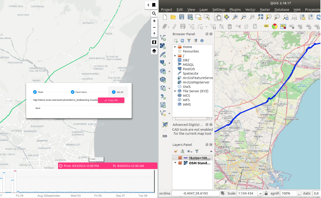
figure 4: Sharing data displayed in ARLAS to visualise it in QGIS
Bookmark
- Allows to save the current filters
- Filters are therefore organised and can be loaded from the bookmark bar
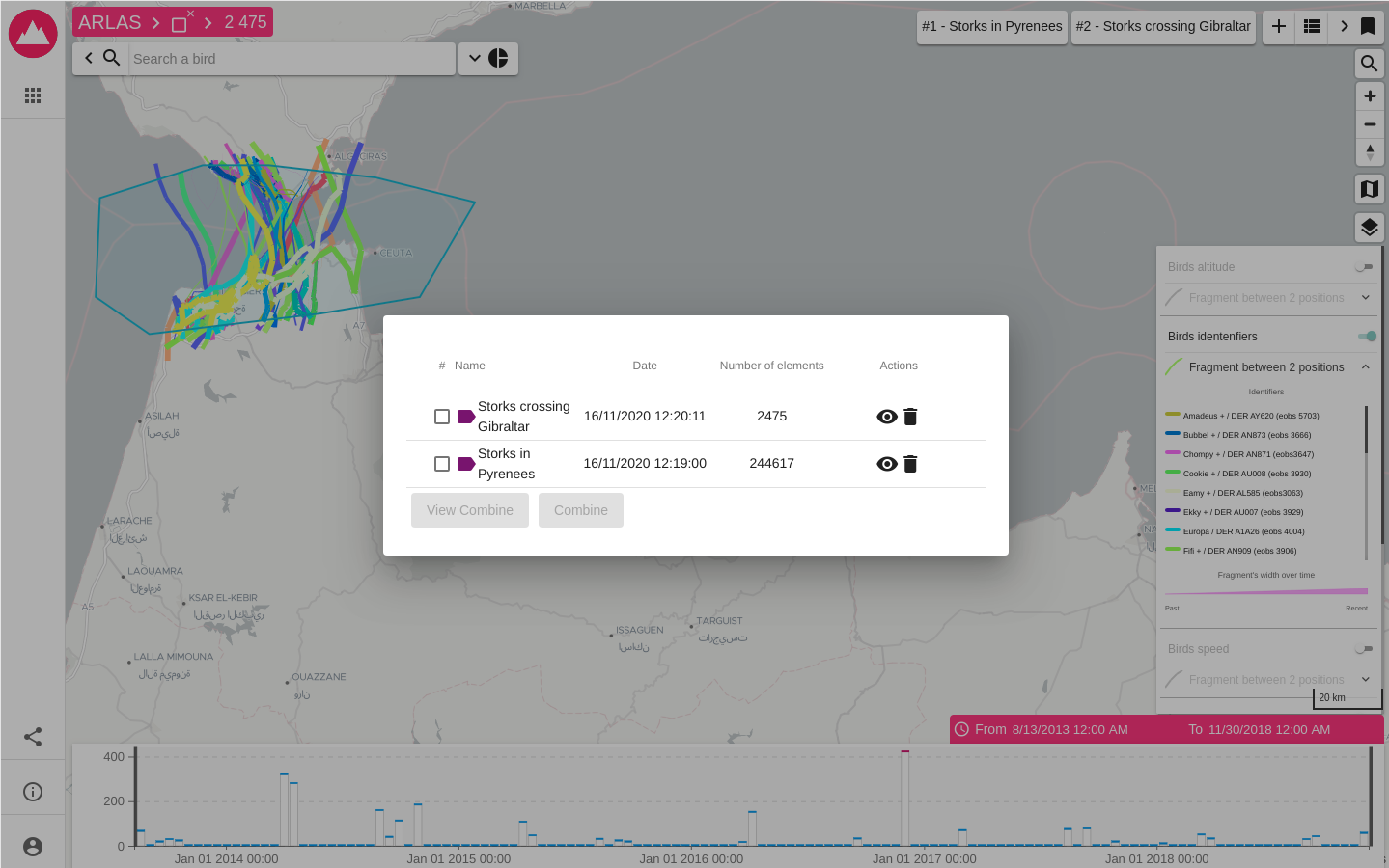
figure 5: Bookmarks
Try it yourself
Demos
Start using ARLAS and explore Stork movements between Europe and Africa, boats navigating in the Danish sea or Air Pollution measurements around the world in our Demo space
Explore your own data
If you have your own spatial-temporal data and want to explore it with ARLAS, this Quick Start guide and Tutorial will help you build your first ARLAS-wui !